
Search our site:

Streamflow Data for Washington
Please select a region to display a map of the stations and retrieve data,
or select a region from the list below.
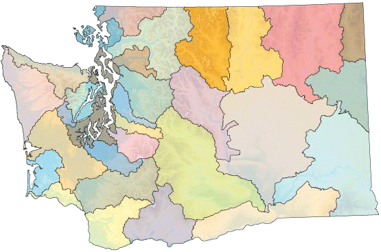
- Naselle and Willapa Rivers
- Chehalis and Humptulips Rivers
- Quinault, Queets, Hoh, and Quillayute Rivers
- Hoko, Elwha, and Dungeness Rivers
- Big Quilcene and Duckabush Rivers, Big Beef Creek
- Skokomish River
- Minter, Chambers, Tulalip and Mission Creeks
- Deschutes and Nisqually Rivers
- Puyallup River
- Duwamish River
- Lake Washington
- Snohomish River
- Stillaguamish River
- Skagit River
- Samish River and Whatcom Creek
- Nooksack River
- Upper Columbia, Kettle, and Colville Rivers
- Pend Oreille River
- Spokane River
- Okanogan River
- Methow and Chelan Rivers
- Entiat and Wenatchee Rivers
- Crab Creek and Esquatzel Coulee
- Yakima River
- Snake River
- Walla Walla
- Klickitat and White Salmon Rivers
- Lower Columbia and Lewis Rivers
- Cowlitz River