
Flood Damage to USGS Gages in Washington, 1996-1997
Updated April 16, 1997
Flooding in 1996 and 1997 throughout Washington State damaged or destroyed numerous U.S. Geological Survey streamflow gaging stations. The damage ranged from minor surficial damage to the complete destruction of the gage. Included in this was damage to cableways used by field technicians to measure streamflow.
The severe damage known to date is summarized below. This damage disrupted the continuous data collection at the site and the real-time data where the station was equipped with satellite telemetry equipment. This report will be updated as damage is better known or repairs are made.
Numerous gages, not listed here, suffered less severe damage which does not necessarily effect the stage or real-time data from the site, but sufficient to warrant repairs. In addition the floods made significant channel changes which will necessitate additional field work to establish updated stage- discharge relationships for the computation of an accurate flow.
The US Geological Survey operates streamflow gages in cooperation with other Federal, State, and local government agencies for the collection, understand- ing and analysis of the water resources in Washington. The loss of or damage to gages is a loss of data and information for everyone needing data from these sites for the operation and management of the water resources of the State.
WESTERN WASHINGTON GAGES
- Skykomish River near Gold Bar, WA (12134500) aerial view | ground view
This gage is a key station for flood warnings and forecasts for the National Weather Service and local emergency management agencies.
The gage was destroyed by the November 29, 1995 flood peak (graph). A temporary gage was installed January 23, 1996. The temporary pressure transducer and electronic data logger will operate until the gage structure can be repaired and the satellite telemetry equipment restored later this spring.
Satellite telemetry was added to the temporary gage in late July for continuous data transmission from the station, (press release).
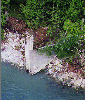
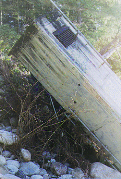
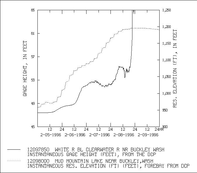
The cableway used to make discharge measurements was damaged when several Douglas Fir trees slid onto and dropped the cable during the December 1996-January 1997 storms. No repairs have been made yet. - White River below the Clearwater River near Buckley, WA (12097850)
This gage is the inflow station to Mud Mountain Reservoir for the U.S Army Corps of Engineers.
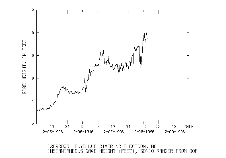
The gage was damaged when Mud Mountain Lake submerged the gage house on February 8, 1996 (graph). - Puyallup River near Electron, WA (12092000)
This gage is helps determine the instream and diversion flow to the flume for Puget Sound Power and Light Company.
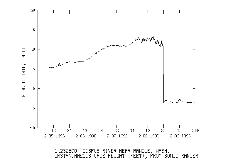
The gage was destroyed February 8, 1996 (graph) when flood waters eroded the approach to the bridge upstream and washed away the gage house and equipment. - Cispus River near Randle, WA (14232500)
This gage helps determine the inflows into Cowlitz Falls Reservoir and Riffe Lake for Lewis County Public Utilities and the Public Works Department, City of Tacoma, Light Division.
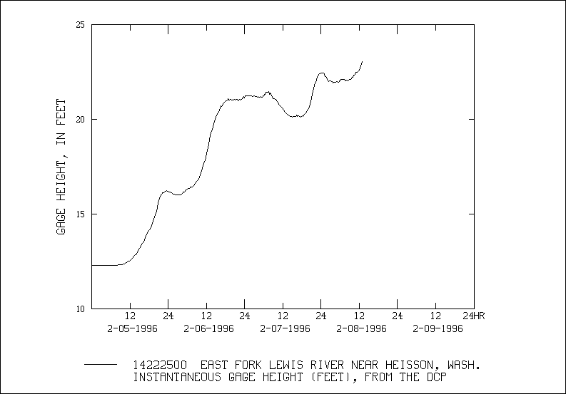
The gage stopped reporting stage data February 8, 1996 (graph) when flood waters damaged a bridge with stage sensors and cables. The cables between the sensors and the gage house were damaged and sections of cables to the sensors were washed away. - East Fork Lewis River near Heisson, WA (14222500)
The gage was destroyed by flood water of February 8, 1996 (graph).
EASTERN WASHINGTON GAGES
- Hangman Creek at Spokane, WA (12424000)
The gage stage sensing equipment in the river was destroyed with the flood waters of February 9, 1996. This stations does not have satellite telemetry. This station is scheduled for repairs in late spring when the flows recede.
Links to Other Data Pages
- Current Hydrologic Conditions
- Historical Data
- Related Hydrologic Information
- Surface Water Reports
- Water Resources Agencies and Information
List of Federal and Washington State Agencies and information resources